Skip to content
Midlands Aerial Surveys

Aerial Farm Surveys

Aerial survey and inspection for farms and estates across Lincolnshire, Rutland and the East Midlands — from one grain store roof to a whole holding recorded in a morning.

Get in touch

Aerial view of a farmstead with a long barn and two grain silos in a stubble field

A farm is one of the hardest things there is to inspect properly from the ground. The buildings are tall, the roofs are fragile, the land is wide, and the things that go wrong tend to be found late — a slipped sheet on a grain store discovered when the barley underneath it is already wet, a blocked dyke found when the headland floods, a gate that moved eighteen months ago and nobody noticed.

An aircraft covers a holding in a morning. It photographs every roof at close range without anybody going up a ladder, records field boundaries, tracks and watercourses as they actually are rather than as the plan says they are, and leaves you with a dated set of imagery you can put in front of a landlord, a tenant, an agent, an insurer or a contractor.

Most of this work is for farms and estates directly. Some of it is for the people who advise them — land agents preparing particulars, consultants wanting an overview before walking a block, solicitors dealing with a boundary that two neighbours remember differently.

We are based in Stamford, which puts most of Lincolnshire, Rutland, Cambridgeshire and Northamptonshire within an easy morning. Travel is worked out for your holding and appears in the written quotation, so the figure you are given is the figure you pay.

What it shows


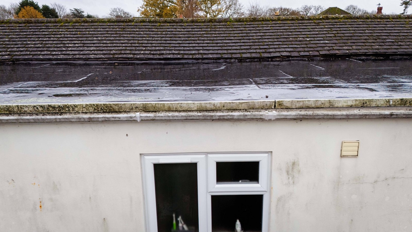
  • Slipped, cracked and delaminating roof sheets on barns, grain stores and livestock buildings
  • Fibre cement roofs that nobody should be walking on in the first place
  • Blocked, split or sagging gutters, valleys and downpipes
  • Blocked dykes, ditches and field drains, and where water is actually standing
  • Field boundaries, hedges and fence lines as they are on the day
  • Access tracks, gateways and hardstanding condition
  • Storm damage across the whole holding in one visit
  • Solar arrays on barn roofs — soiling, damage and vegetation shading
  • Grain and muck heaps, and how much yard space is actually left
  • Encroachment, fly-tipping and unauthorised access
  • Buildings and yards nobody has looked at properly in years

Save time and money — a whole holding photographed in a morning instead of walked over a fortnight.

Get in touch

One visit instead of a fortnight of walking


The practical argument for flying a farm is time. Walking a holding to check every roof, gate and ditch is a job that gets postponed until something goes wrong, because it takes days and there is always something more urgent in front of it.

An aircraft does the looking in a morning and leaves you the evidence. You review it sitting down, and you spot the things you would have walked past.

The second argument is safety. Fibre cement roofs on agricultural buildings are among the most dangerous surfaces in the country to walk on, and falls through them are a recurring cause of serious injury. Nobody needs to go up there to find out whether a sheet has cracked.

Corrugated fibre cement farm building roof and brick gable seen from directly overhead

What you get


Full-resolution imagery

Every roof and elevation photographed close enough to see a cracked sheet, supplied as files you can forward to a contractor or an insurer.

A whole-holding map

An orthomosaic of the land flown, showing boundaries, tracks, watercourses and buildings as one continuous image.

A dated record

Every file carries the date it was flown, which is what makes it useful in a dispute, a claim or a tenancy negotiation.

A plain-English note

What was flown, what stood out, and what we could not see. No jargon and no padding.

Files you can actually use

Standard image formats and PDFs. Nothing that needs specialist software to open.

Why A Farm Is Worth Flying Rather Than Walking

Farms are the clearest case for aerial inspection there is, because almost everything that needs checking is either too high, too fragile or too far apart to check any other way.

  • Roofs nobody can safely walk on. Fibre cement sheeting becomes brittle with age and gives way without warning. It is the most common way people are seriously hurt on farm buildings.
  • Buildings scattered across a holding. Ten minutes of flying covers what an hour of driving between yards does not.
  • Water you cannot see from the gate. Standing water, blocked dykes and failing field drains show up immediately from above and are close to invisible from the ground.
  • Things that changed while you were not looking. A moved fence, a widened gateway, tipping in a back field, a track cut across a headland.

Most holdings we fly turn up at least one thing the owner did not know about. It is usually a roof.

Fibre cement barn roof photographed from above, heavily colonised by yellow lichen with cracked sheets visible
Farm machinery yard with tractors and a harvester lined up beside farm buildings
Survey drone flying above rows of apple trees in blossom
Arable field with tramlines running to a hedge line, photographed from the air

What We Do Not Do On Agricultural Work

Worth saying plainly, because the agricultural drone market is full of claims that do not survive contact with the equipment.

  • No crop health or vigour indices. Those need a multispectral sensor. We do not have one and will not pretend otherwise.
  • No measured land survey. No ground control, so no areas or levels to a stated tolerance, and nothing suitable for a subsidy claim or a title plan.
  • No spraying, seeding or any other payload work. Different aircraft, different authorisation entirely.
  • No thermal. No heat-loss surveys on farmhouses and no thermal checks on solar arrays.

What is left is genuinely useful and covers most of what a farm actually needs: condition, damage, drainage, access, and a dated record of how things were.

Large commercial glasshouse complex set among arable fields in Lincolnshire
Block of trees and a farm track running through a stubble field
Survey vehicle and pilot on a farm track between hedgerows during a drone survey

Who asks for it


  • Farms and mixed holdings
  • Landed estates
  • Land agents and rural surveyors
  • Farm consultants
  • Tenant farmers and landlords
  • Rural solicitors
  • Insurers and loss adjusters
  • Contractors quoting for roof or drainage work

What clients get from working with us


Timescales

Most sites are surveyed within two working days of instruction, with reports sent 24 hours after surveys.

Deliverables

Orthomosaics, 3D models, point clouds, elevation sets and edited media, supplied in the formats your team already works in.

Coverage

Operating throughout the East and West Midlands, Yorkshire and East Anglia.

Compliance

Fully authorised and insured, with a site-specific risk assessment issued before every attendance.

Continuity

One point of contact from enquiry to delivery. Data is processed in-house and is never passed to a third-party bureau.

Certainty

A fixed written quotation against an agreed deliverable. No day rates and no variation after the event.

Questions


Do you need to come onto the land?

Usually only to take off and land, and often not into the field in question at all. We agree an access point with you beforehand.

Will it disturb livestock?

We plan around it. We fly higher over stock, avoid lambing and calving areas entirely unless asked, and if animals react we stop. Tell us where they are when you enquire.

Can you measure field areas?

We can give indicative areas from the imagery, which is fine for planning, cropping and general management. Anything going into a land registry entry, a subsidy claim or a contract needs a measured survey with ground control — a different job and a different professional.

Can you tell me where my boundary legally is?

No. We can photograph exactly where the hedge, fence and ditch are on the day, which is often what an argument actually turns on. Where the legal boundary sits is a question for your solicitor and the title plan.

Do you do crop health imaging?

No. That needs a multispectral camera, which we do not carry. We photograph what an ordinary camera can see — condition, damage, drainage and access, but not plant health indices.

How much of a holding can you cover in a visit?

A few hundred acres of land and a full set of farmstead buildings is a comfortable morning. Tell us the acreage and the number of buildings when you enquire and we will say honestly what fits.

What about the weather?

We move the date rather than fly in wind or poor light. On a farm that is usually easy, because the work is rarely urgent to the day.

Tell us about the site and we will take it from there

A site postcode and a sentence about what you need is enough to get started.

Get in touch

Get in touch


Provide a site postcode or boundary and a short description of the required output. We will confirm the deliverables, level of detail.

  • A site postcode is sufficient to price most instructions
  • Written quotation, in most cases the same working day
  • Deliverables and formats agreed at instruction

info@midlandsaerialsurveys.co.uk

Stamford, Lincolnshire